
With more cruisers using AIS, we have to climb the learning curve. A recent guest post explained why what we see on our charts doesn’t match what we see with our eyes. Dave Skolnick reached out to me to add to the nuances of AIS. In this post, he explains that AIS and aids to navigation (AtoNs) have more overlap than one might expect.
Terminology
Let’s start by reviewing the standard terminology.
Two types of entities play a role in AIS-enabled aids to navigation. The navigation authorities are the International Maritime Organization (IMO) and US Coast Guard (USCG). The communications authorities include the International Telecommunications Union (ITU) and US Federal Communications Commission (FCC).
Both navigation and communications authorities play a role in AIS-enabled aids to navigation. They all work together cooperatively!
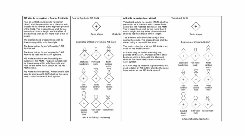
Real AtoNs are physical items only. If you look out at the water, you should see a buoy, daymark, or other aid. Right where your electronic or paper chart says there will be one.
A synthetic AtoN is a real mark that also shows up as an AIS target. These have a lot of advantages to boaters as well as ships.
You get all the closest point of approach (CPA) and time to closest point of approach (TCPA) results that you would with MARPA (a radar plotting aid that tracks radar targets) on radar or laborious hand calculations without spending time setting up targets. Further, there are benefits when things go wrong. We’ll review some examples below. ]
Together, CPA and TCPA tell you in distance and time whether a collision is likely. And how much time you have to react.
A virtual AtoN has no physical existence. It only exists as an AIS target. We’ll explore examples of why this is also a great idea.
Why AIS-enabled AtoNs?
Why would authorities implement AIS-enabled AtoNs?
For one, they improve safety. Boaters can see them on electronic charts long before you can see them with binoculars.
Additionally, authorities can update their locations more quickly.
For example, in Barnegat Inlet in New Jersey the channel moves with every major storm. It takes a few days to physically move the marks.
However, the Coast Guard can update synthetic or virtual marks with the push of a button as soon as they survey the new channel. So the AIS markers will be updated before the real buoys are moved.
AIS-enabled AtoNs are budget-friendly also. Particularly for deepwater marks like safe water buoys.
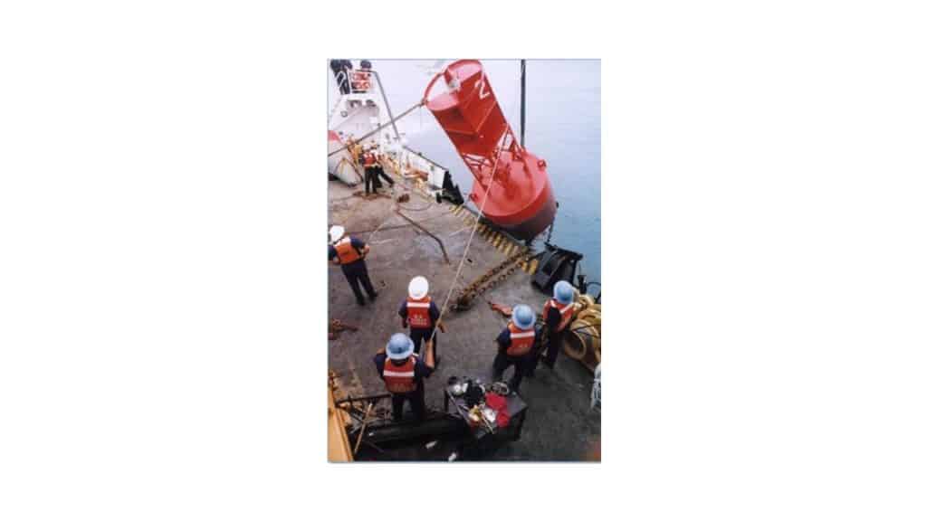
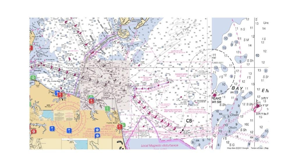
Deepwater buoys, such as CB at the end of the southern channel into the Chesapeake Bay, are hideously expensive to maintain. Although that buoy is now synthetic, its days as a physical buoy are numbered. Eventually, they will become virtual.
It is worth considering that your AIS receiver or transponder and its display have no idea where the AIS transmitter is. They only know where the signal says that the AtoN is. This opens up some interesting capabilities.
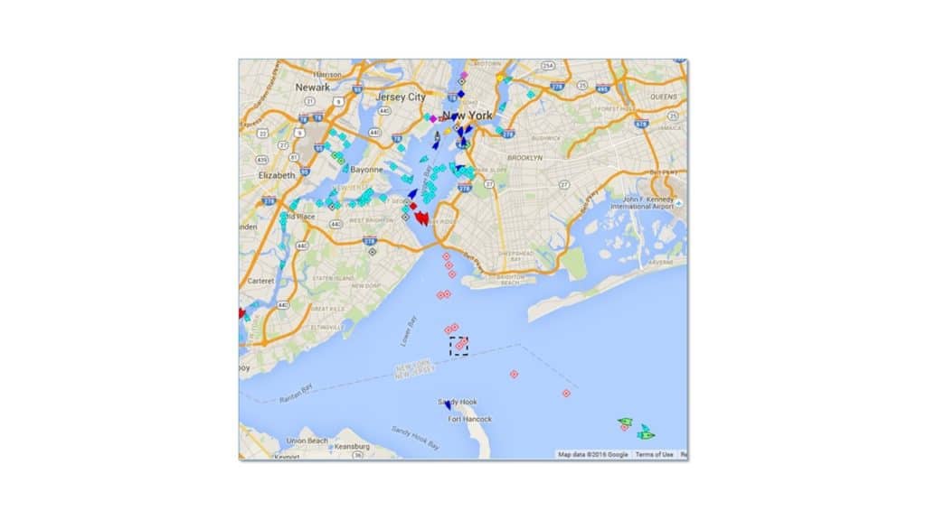
For example, when the first AIS-enabled AtoNs were evaluated in New York City in 2014, the signals for all the buoys in the upper and lower bays were sent by a single transmitter on the Verrazano Narrows bridge. That architecture continues to this day. Given sufficient height and line of sight, there is no need to put a transmitter on each mark when one can serve the need from a warm, dry equipment closet with plenty of power. Using a single land-based transmitter also cuts down on the cost of the initial installation and ongoing maintenance.
Some newer AIS-enabled AtoNs also have AIS receivers and transmitters that are designed to relay—at much higher power and range—the signal from AIS search-and-rescue transmitters (SART) from crew overboard. This is huge from a safety standpoint.
The boat you fell off of and others in the immediate vicinity are in the best position to rescue you right now!
Example
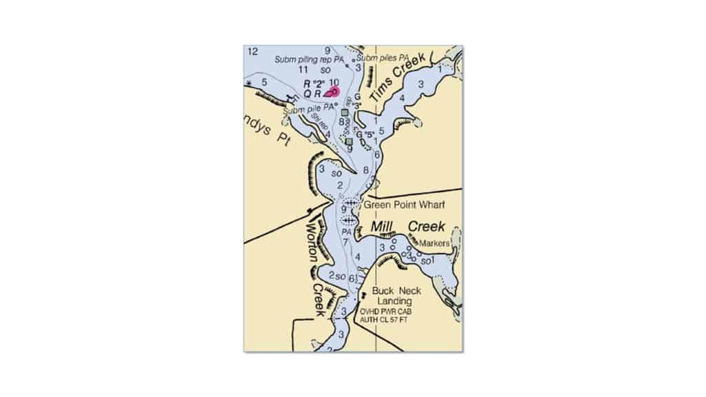
Let’s consider a scenario in which superficially something looks wrong. You look at your chart and know where a buoy should be. It isn’t there. You see it at some distance and at an angle from where you expect it. Your chart plotter shows an AIS target for the mark in a third location. Which is “right?”
We know that chart data, even updated from local notices to mariners (LNTM), are often out of date. So the chart position is suspect.
Buoys can drag in heavy weather and may even become adrift, so the position where you’re seeing the physical AtoN is also suspect.
While there is always the possibility that an AIS location could be entered wrong that is very unlikely to go uncaught. So the AIS AtoN is almost certainly the most reliable. Set course accordingly.
Note that AIS AtoNs identify themselves so you will not confuse one for another even if it does not match the charted position.
On Your Boat
Will YOU see the AIS-enabled AtoNs? It depends on the brand and model of navigation hardware and software you’re using, as the AIS signal uses a different message type (type 21 for the technically inclined) than the Class A, B, and B-plus signals we see displayed from boats and ships.
As of mid-February 2021:
- OpenCPN and all Vesper products properly show AIS-enabled AtoNs.
- Some Navico products (so B&G, Simrad, and Lowrance) work.
- Digital Yachts products work.
- The latest version (as of mid-February 2021) of AquaMap on iOS works.
- Some Garmin products including the 6212 and 8212 are known NOT to work out of the box as are some Actisense interfaces including NGW-1-ISO-AIS.
- We have contacted Navionics to determine their support for AIS-enabled AtoNs and will update this article if/when we hear back.
- 70 to 80 percent of commercial ECDIS (the commercial navigation systems used on ships) are reported to work.
If yours is one of those that does not work, it is almost certain that updating the firmware will solve the problem. Haul out your user’s manual and fire up the Internet and make sure you are running the latest firmware available from your plotter’s manufacturer. You should have a routine schedule for updating firmware, just like you have a regular schedule for changing your engine oil.
Future Uses
Not yet legally available but of interest to those active in yacht clubs and other sailing organizations are AIS-enabled private aids. Consider the value of adding synthetic and/or virtual marks to a long winding entry to a facility such as The Oyster Farm at Kings Creek in Cape Charles VA or Bush RiverYacht Club in Abingdon MD.
Think of all the tricky “local knowledge required” entrances along the ICW and in the Florida Keys. They can become straightforward, reducing stress for boaters and bringing visitors to outposts. The winding paths into Elizabeth Harbor in the Exumas might be better marked by a joint effort of Saint Francis Resort and the Chat and Chill.
The possibilities are endless. Recognize that for now, regulation for AIS-enabled private AtoNs is working its way through the USCG and FCC (and equivalents in other countries) but there is a little resistance.
It will come.
Synthetic and virtual AtoNs are operational today. That is a good thing. AtoNs are just one more reason that adding at least an AIS receiver to your electronics is a good idea. VHF radios with integrated AIS receivers are available for less than $400.
Dave Skolnick is a naval architect and marine engineer. He provides electronics services, yacht management, and deliveries from his base in Annapolis MD. He speaks and writes on a broad range of cruising topics. Write to Dave at [email protected].

Paul Mac Menamin says
Very timely article. I have been looking into AIS transceivers, and had not realized that virtual AtoNs had now become real!. What a great use of the technology.
WANITA Meed says
We have Navionics – looking at getting your update by May 2021, hopefully!