• Skip to main content
  • Home
  • New? Start Here
  • Articles
    • WHAT IS CRUISING?
    • COULD I CRUISE?
    • GETTING READY TO GO
    • FIRST YEAR REALITY
    • Preparing to Cruise
    • Buying a Boat & Gear
    • Living on a Boat
    • Food & Cooking
    • Cruising & Chartering
    • Boat Work
    • Worries & Concerns
  • Cruising Guides
  • Courses
  • TBG on Amazon
    • Our Products on Amazon
    • Other Recommended Products on Amazon
  • Course Login
  • Newsletter
  • Visit Our Store
    • Cruising Guides
    • Courses
    • Books & References

The Boat Galley

making boat life better


When You're Underway
Image is not available

SEE REFERENCES AND ORGANIZERS

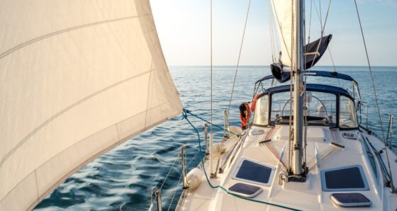
Life underway is full of excitement and fun, but can be challenging too.
 
Here's some of our "standard operating procedures" that reduce the stress and increase the enjoyment.

How to Avoid Bad Sailing Days

Published on May 31, 2026; last updated on June 2, 2026 by Carolyn Shearlock

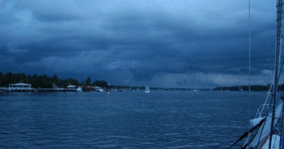
Had a trip from hell and wondering if this is really what you want to be doing for “fun?” Future trips will almost certainly be better – here’s why.

Electric Windlass as a Safety Feature

Published on May 27, 2026; last updated on May 29, 2026 by Carolyn Shearlock

Electric windlasses aren’t cheap and require attention to detail in their installation, but provide important safety benefits.

Weather Basics For Boaters

Published on April 30, 2026; last updated on April 30, 2026 by Carolyn Shearlock

Cover of Weather Basics for Boaters: The Details That Matter by Carolyn Shearlock, shown beside a screenshot of the Windy.com weather app displaying wind and current overlays for the Florida and Bahamas region with a panel of selectable forecast layers including waves, swell, clouds, and currents.

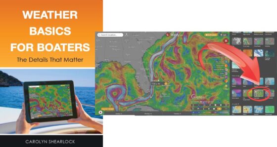
Book: A practical, easy-to-understand guide to using weather apps like Windy and PredictWind to make confident go/no-go decisions on the water. Read past the overview, find the layers and data most boaters never see, and translate forecasts into what you’ll actually feel.

Maine and New England Cruising Guide

Published on April 30, 2026; last updated on April 30, 2026 by Carolyn Shearlock

Cover of The Boat Galley New England Quick Reference Cruising Guide, dated April 2026, featuring an aerial view of a New England harbor in autumn with sailboats on moorings and fall foliage along the shore, shown above a sample interior page displaying the Anchorages & Mooring Fields table with columns for location, Active Captain name, depth, tide, protection by direction, holding, current, wake, dog walking, dinghy access, moorings, and notes; a small map at lower left highlights the New England coast from Cape Cod through Maine.

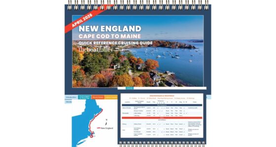
Cruising guide: Quick reference for New England from Cape Cod to Eastport, Maine — anchorages and mooring fields by protection direction, storm holes, free docks, fuel, propane, pumpouts, dog walking, bridges, inlets, and haulouts. Buzzards Bay, the Vineyard, Nantucket, Boston, Casco Bay, Penobscot Bay, MDI, and Down East in one book.

Florida Gulf Coast Cruising Guide

Published on April 30, 2026; last updated on April 30, 2026 by Carolyn Shearlock

Cover of The Boat Galley Florida Gulf Quick Reference Cruising Guide, dated July 2025, featuring a sunset view of the St. Marks Lighthouse, shown above a sample interior page displaying the Services table with columns for location, name, VHF, phone, depth, fuel, laundry, showers, grocery, water, pump out, and notes; a small map at lower left highlights the coverage area along the Florida Gulf Coast from Mobile, AL through Tampa, Fort Myers, and Key West to the Dry Tortugas.

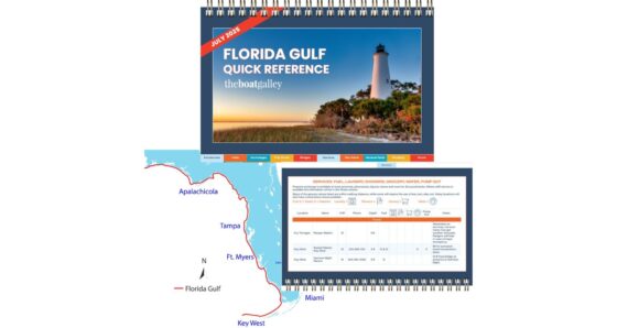
Cruising guide: Quick reference for the Florida Gulf Coast from Dry Tortugas to Mobile, AL — anchorages by protection direction, all bridges, inlets, free docks, fuel, propane, pumpouts, dog walking, and haulouts. SW Florida, Tampa Bay, the Big Bend, Forgotten Coast, Emerald Coast, and Mobile Bay in one book.

Chesapeake Bay Cruising Guide

Published on April 30, 2026; last updated on April 30, 2026 by Carolyn Shearlock

Cover of The Boat Galley Chesapeake Bay Quick Reference Cruising Guide, dated September 2025, featuring a sunset view of the Chesapeake Bay Bridge, shown above a sample interior page displaying the Anchorages & Mooring Fields table with columns for location, Active Captain name, depth, tide, protection by direction, holding, current, wake, dog walking, storm hole, and notes; a small map at lower left highlights the Chesapeake Bay from Baltimore through D.C. and Norfolk.

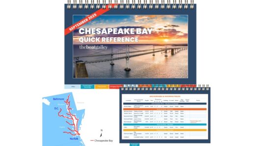
Cruising guide: Quick reference for the Chesapeake Bay from Norfolk to the C&D Canal, both Eastern and Western Shores, all rivers including the Potomac to DC — anchorages by protection direction, bridges and ferries, free docks, fuel, water, pumpouts, groceries, and haulouts.

Florida Keys & Florida Loop Cruising Guide

Published on April 29, 2026; last updated on April 30, 2026 by Carolyn Shearlock

Cover of The Boat Galley Florida Keys and Okeechobee Waterway Quick Reference Cruising Guide, dated November 2025, featuring the Southernmost Point buoy in Key West, shown above a sample interior page displaying the Haulouts and Boat Yards table with columns for mile marker, name, phone, travel lift, max beam, max length, depth, allow DIY, stay aboard, and notes; a small map at lower left highlights the Florida Loop route from Stuart through Lake Okeechobee, Fort Myers, the Gulf Coast, Key West, and Miami.

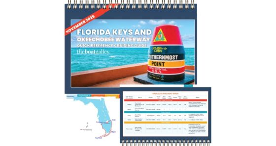
The Boat Galley Florida Keys & Florida Loop Cruising Guide is the cockpit-friendly cruising guide covering the Florida Keys, SW Florida, and the Okeechobee Waterway — the entire Florida Loop (also called the South Florida Loop or Smuggler’s Run) in a single book. Organized by location in a north-to-south sequence (or by mile marker on […]

ICW Cruising Guide

Published on April 29, 2026; last updated on April 30, 2026 by Carolyn Shearlock

Cover of The Boat Galley ICW Quick Reference Cruising Guide, dated October 2025, shown above a sample interior page displaying the Anchorages & Mooring Fields table with columns for mile marker, Active Captain name, depth, tide, protection by direction, holding, current, wake, dog walking, and notes; a small map of the U.S. East Coast at lower left highlights the Atlantic ICW from Norfolk through Beaufort, Charleston, Savannah, Cape Canaveral, West Palm Beach, and Miami.

Cruising guide: Quick reference for the entire Atlantic ICW from Norfolk, VA to Miami, FL — bridges with height and schedules, anchorages by protection direction, storm holes, fuel, propane, pumpouts, free docks, dog walking, inlets, and haulouts, all listed by mile marker.

Bahamas Sailing & Cruising Guide

Published on April 29, 2026; last updated on April 30, 2026 by Carolyn Shearlock

Cruising guide: Quickly find anchorages by protection direction, dog walking, services including fuel, water, ATMs, propane, groceries, haulouts with max. beam and more — for the entire Bahamas.

VHF Radios: Everything You Need To Know

Published on April 29, 2026; last updated on April 30, 2026 by Carolyn Shearlock

How to properly use a VHF radio

Online course: How to use your VHF radio confidently — routine calls, emergency procedures, channel selection, plus advanced features like DSC and AIS. Your VHF is more than a glorified walkie-talkie.

  • Page 1
  • Page 2
  • Page 3
  • Interim pages omitted …
  • Page 12
  • Go to Next Page »
About · Privacy · Terms of Service · Contact · © 2010–2026 The Boat Galley, LLC. All Rights Reserved.'
  • Questions? Click to Email Me
  • Visit Our Store