

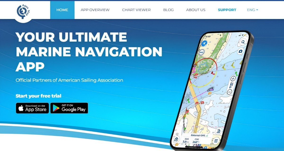
Aqua Map is a free iOS and Android navigation app that turns a phone or tablet into a full chartplotter, and it’s the one I recommend most to cruisers on the US East Coast, the ICW, and in the Bahamas. The app costs nothing to download. You pay only for the chart regions you need, plus an optional yearly subscription for the advanced tools.
I first reviewed Aqua Map in 2019. When our chartplotter failed later that year, Aqua Map took over, and we liked it so much better that it stayed our primary navigation aboard Barefoot Gal. These days I still use it when I’m helping friends plan a trip or talking with readers at in-person events. The app has changed so much since that first review that this is essentially a brand-new one.
Full disclosure: The Boat Galley earns a commission when you buy charts through our dealer link (which also gets you 20% off). I was using and recommending Aqua Map before that arrangement existed.
What Aqua Map Does Best
A few things set Aqua Map apart from other navigation apps:
- Free updates, anytime you have internet. Chart updates, USACE surveys, the Coast Guard Light List, and Local Notices to Mariners all update whenever your device is online, at no extra charge. With “forever” charts, you keep getting chart updates year after year without paying again.
- Official charts, updated regularly. Aqua Map uses charts from official sources such as NOAA in the US and the Canadian Hydrographic Service. They download to your device, so they work offline.
- Explorer charts for the Bahamas. These are the charts most Bahamas cruisers trust, and Aqua Map offers them in vector format (more on why that matters below).
- US Army Corps of Engineers surveys. More than 90,000 USACE depth surveys sit right on the chart and update weekly. On the ICW, where channels shift faster than the charts are updated, this is the feature people rave about.
- Bob423’s ICW tracks, synced automatically. Turn it on once and the latest version of Bob’s tracks appears on your chart whenever you have internet.
- ActiveCaptain and Waterway Guide info at no extra cost. Marinas, anchorages, hazards, and reviews show up as icons on the chart, and you don’t need an account with either one.
- Use it on up to 5 devices. One purchase covers up to five phones and tablets, and iOS and Android can be mixed.
- A real anchor alarm. It’s free for everyone. With a subscription, you can also watch it from a second device while you’re ashore.

Where Aqua Map Has Charts
Aqua Map’s coverage has grown a lot since I first wrote about it. As of November 2026, its chart list includes:
- North America: USA, Canada, Bahamas, Bermuda, Cuba, and Mexico (including Blue Latitude Press charts for the Sea of Cortez and Pacific Mexico)
- Caribbean
- South America: Argentina, Brazil, the Guyanas, and Suriname
- Europe: Belgium, Croatia, Denmark, Estonia, Faroe Islands, Finland, France, Germany, Greece, Greenland, Iceland, Ireland, Italy, Malta, the Netherlands, Norway, Poland, Portugal, Spain, Sweden, Turkey, and the UK
- Oceania: Australia, New Zealand, Fiji, and Vanuatu
- Africa and Asia: Cape Verde, Seychelles, South Africa, the Maldives, and the UAE
New areas are added regularly. To see exactly which waters are covered, look at the chart viewer on Aqua Map’s website, or download the free app and browse the chart store before you buy anything.
Aqua Map in the Bahamas
If you’re cruising the Bahamas, Aqua Map is one of the best tools you can have. It uses the Explorer charts, the same cartography as the printed Explorer Chartbooks that Bahamas cruisers have trusted for decades. The colors and symbols match the paper books, so it’s easy to cross-check one against the other.
The big change since my first review is that Aqua Map created vector versions of the Explorer charts. When I first wrote this article, the Bahamas charts were raster charts (essentially scans of the paper charts). That caused a real annoyance: my US charts showed depths in feet, but the Bahamas charts stayed in meters no matter what I set.
The vector charts fix that. You can switch depths to feet, tap objects for more information, and zoom in without the chart going fuzzy. If you prefer the classic look of the paper charts, there’s a setting to turn the raster version back on.
Aqua Map earned its place on our boat during a 3-month Bahamas cruise. Our chartplotter started failing on the way over and was useless by the time we headed home, so we switched to Aqua Map on the iPad. We liked it so much better that we never switched back: Aqua Map became our primary navigation, and the chartplotter became the backup.
Planning Routes With Aqua Map
Route Planner is free for everyone and can build a route three ways:
- Automatic: you set the start and end, and it plots the route between them
- Manual: you tap in each waypoint yourself
- Hybrid: a mix of both in the same route
Automatic routing checks your boat’s draft and air draft against the chart and flags shallow spots and low bridges. You have to download the chart areas first.
I’ll be honest: I’m not a fan of auto-routing. It’s handy for a quick look at roughly how a trip might go, but I would never follow an automatic route without checking every leg myself. No app knows about every new shoal, and a line drawn by software can cut a corner you’d never cut. On the ICW especially, compare it against the USACE surveys and Bob’s tracks, and in the Bahamas, against the Explorer charts and your own eyes.
A feature I’ve always loved is route info. Tap it while you’re navigating and it shows the time and distance to every waypoint ahead, not just the next one. Our chartplotter only showed the next waypoint and the final destination. When you’re trying to make a bridge opening, knowing exactly when you’ll reach it matters.

Route Explorer (part of the paid subscriptions) goes one step further. It scans your whole route and lists every bridge, lock, hazard, marina, anchorage, and fuel stop along the way, with an arrival time for each.
How Much Does Aqua Map Cost?
The app is free. Charts and advanced tools are separate purchases, and every subscription comes with a 14-day free trial.
Charts are bought by region. Depending on the region, you can choose a subscription or a “forever” purchase that keeps updating at no extra cost. Prices vary by region, so check the chart store in the app for the area you want.
Advanced tools come in two levels (prices as of November 2026):
- Expert, $14.99 a year: marine weather forecasts up to 40 hours ahead, Route Explorer, AIS display, Wi-Fi connection to your boat’s instruments (depth, wind, GPS), and remote anchor alarm monitoring with email or Telegram alerts
- Master, $24.99 a year (US and Canada only): everything in Expert, plus the USACE surveys, US Coast Guard data for more than 54,000 aids to navigation updated daily from the Local Notices to Mariners, and Canadian Coast Guard navigation warnings
Both require a chart purchase. If you cruise the ICW, get Master. The USACE surveys alone are worth it.
The Boat Galley Discount
Through our Aqua Map dealer page, you get 20% off bundles that combine forever charts with a Master or Expert subscription. Bundles cover North America, the Bahamas, the Caribbean, Mexico, South America, Europe, and Oceania.
The North America bundles can also include a PDF copy of one of our quick-reference cruising guides at a discount. Download the free app first, then buy the bundle through the link.
Aqua Map vs. Navionics
Navionics (now owned by Garmin) is the other app most cruisers consider. Both are good, and plenty of experienced ICW cruisers run both. Here’s how they differ in practice:
- Bahamas charts: Aqua Map uses the Explorer charts. Navionics does not; it uses its own cartography. For the Bahamas, Explorer is what I’d want.
- Shoal information on the ICW: Aqua Map shows the official USACE surveys. Navionics relies on SonarChart, which is built from depth readings that other users upload.
- Updates and cost: both apps update charts frequently while you’re paying. Navionics is a yearly subscription ($49.99 a year for US and Canada as of November 2026), and in the app, your charts and updates depend on keeping it active. Aqua Map gives you a choice: a 1-year subscription (updates stop when it ends unless you renew) or “forever” charts, where you pay once and keep getting free chart updates for as long as you use them.
- Garmin chartplotters: if you have a Garmin plotter with Navionics charts, Navionics’ Plotter Sync moves routes to the plotter wirelessly. That’s a real plus for Navionics.
- Ease of use: I found Aqua Map clearer and simpler to use underway, with less clutter on the chart. Others prefer Navionics. Both have free trials, so try them side by side.
Using Aqua Map With Your Chartplotter and Other Devices
Aqua Map works as a complete backup to your chartplotter, or as your primary navigation. I’m a belt-and-suspenders sailor, and on Barefoot Gal we always had at least two systems running. I wrote more about how we set that up (and the day we made landfall on a smartphone) in Boat Navigation Redundancy: Always Have a Backup.
To get a route onto your chartplotter, export it from Aqua Map as a GPX file. Then load it onto the plotter the way your plotter’s maker supports, usually with an SD card or the maker’s own app. Note that waypoint numbering may differ between devices.
Sharing between your own devices is easier. Set up a free GEC account (Aqua Map’s account system) and log in on each device. Your charts, subscriptions, routes, markers, and tracks follow you to up to five devices.
A few practical tips:
- Wi-Fi-only iPads don’t have GPS. You’ll need an external GPS or another way to get position data. I explained an inexpensive fix in GPS to WiFi iPad for Aqua Map.
- Protect the tablet. If it’s going to live at the helm, a truly waterproof case is a must. We used a ugo waterproof tablet case that floats and lets the touchscreen work through it.
- Watch for overheating. In strong sun, tablets overheat faster than phones. Keep a backup device in the shade.
Learning Aqua Map
There’s a learning curve, as there is with any navigation system, but Aqua Map now offers a lot of help:
- 12 video tutorials on its website, covering getting started, Route Planner, managing charts, anchor alarms, Wi-Fi connections, AIS, Route Explorer, and more
- Recorded webinars on more advanced topics
- A downloadable user guide and an online help center
Learn the app at the dock, not underway. Plot a route or two while you have internet, try the anchor alarm on a calm night, and make sure you know how to export a route before you need to.
If you’re headed down the ICW, my guide to cruising the ICW for the first time covers how Aqua Map, Bob’s tracks, and the USACE surveys work together in the shallow spots.
The Bottom Line
Aqua Map is the navigation app I recommend most to cruisers on the US East Coast, the ICW, and in the Bahamas. It combines official charts, Explorer charts in the Bahamas, USACE surveys, Bob’s tracks, and Coast Guard data in one clear app, and all of it updates free whenever you have internet.
Whether you use it as your primary navigation or as the backup that saves the day when the chartplotter quits, it earns its spot on your tablet.
Know What’s Ahead, Not Just Where the Water Is
Aqua Map shows you where the deep water is. Our quick-reference cruising guides handle everything else, and they’re built to sit right beside your nav app (they don’t include charts). They tell you which anchorage is protected from tonight’s wind, when the next bridge opens, and where to find fuel, groceries, pumpouts, and a free dock.
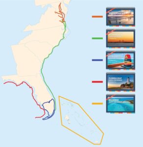
From The Boat Galley Store
Quick Reference Cruising Guides
Find what you need instantly, with no hunting through dense text.
- Anchorages sorted by protection direction, plus storm holes and dog walking
- Bridges with clearance, VHF channel, and opening schedules
- Free docks, fuel, groceries, pumpouts, and propane fills
- Haulouts with max beam, DIY rules, and whether you can stay aboard
ICW, Bahamas, Florida Keys, Florida Gulf Coast, Chesapeake, and Maine and New England. Print and instant PDF.


Carolyn Shearlock has lived aboard full-time for 17 years, splitting her time between a Tayana 37 monohull and a Gemini 105 catamaran. She’s cruised over 14,000 miles, from Pacific Mexico and Central America to Florida and the Bahamas, gaining firsthand experience with the joys and challenges of life on the water.
Through The Boat Galley, Carolyn has helped thousands of people explore, prepare for, and enjoy life afloat. She shares her expertise as an instructor at Cruisers University, in leading boating publications, and through her bestselling book, The Boat Galley Cookbook. She is passionate about helping others embark on their liveaboard journey, making life on the water simpler, safer, and more enjoyable.
Some links in this article (including all Amazon links) are affiliate links, meaning that we earn from qualifying purchases.